Showing posts with label Skagit River. Show all posts

Thursday, July 18, 2024

Flying Google Earth From Texas To Visit My Old Washington Home Zone


Last night I flew Google Earth from my current home zone to my old home zone of Washington state. It had been a few years since I had flown home via this method.

I first checked out the town I grew up in, Burlington, going down Fairhaven Avenue, that being the main drag through town. Much had changed, including what looked to be a lot of new landscaping at the area train tracks intersect with, I think, Highway 20, that being the rode which takes you to North Cascades National Park.


When I got to my old home, across from Maiben Park, I saw something which clued me as to why I find a certain aspect of Texas to be a bit appalling.

That being the sad state of sidewalks in the Lone Star state.

The sidewalk in front of the house I grew up in is wide, with a grass median between the sidewalk and the road. A feature I rarely, if ever, have seen in Texas. And now a sidewalk has been added on the park side of the street.

The house I grew up in is the one in the middle. Seeing the sidewalk, with the median between sidewalk and road, I understand why I find the Texas sidewalks so appalling.


After several minutes in Burlington I headed south to Mount Vernon. The first thing I checked out in Mount Vernon was the Riverwalk along the Skagit River.

The Mount Vernon Riverwalk was built as part of a flood control project. Previous to this new flood control method sandbags were used to build a walk to keep downtown Mount Vernon from being flooded. Now a temporary wall can be assembled quickly by just a couple wall builders, not the hundreds of volunteers it took to build a sandbag wall.


The Texas town I used to live in, Fort Worth, has been trying to build a new flood control method in an area which has not flooded since the 1950s, because flood control levees already prevent such from happening. Fort Worth's slow-motion project, limping along for most of this century is known as the Trinity River Vision, purported to be a vitally needed flood control and economic development plan.

So vitally needed that, so for, the only major part of that Vision which can be seen is three simple little freeway overpass type bridges, built over dry land, to connect the Fort Worth mainland to an imaginary island.

The river that flows through Fort Worth is the Trinity River. This is not a Skagit River type river. As you can sort of see in the above photo, the Skagit River looks like it is flowing clean, clear water. The Trinity River looks like flowing mud, and in flood mode that flowing mud is covered with litter.

That photo at the top is the house I lived in before moving to Texas. Built in 1985 for only $65,000. Sold in 2002 for $132,000. And recently I saw the house has been sold again for a little under a hall million bucks. 

Such seems so bizarre to me. That anyone would pay that much for that house. Only three bedrooms, two bathrooms. And no walk-in closets. The decks in front and back were rather nice, there is that. I had a great roof top garden in the front patio, with two big blueberry bushes, among many other vegetative things, including a lot of basil.

I'm appalled to see a garage door has been added to the open carport, not matching the look of the rest of the house. I see the stairs leading to the front door have been totally re-done. And why is there what looks to be a big plastic tarp above where my bedroom was?

I guess it really is true, you can't go home again. And expect all to be the same as you remember it...

Saturday, October 15, 2022

Washington Drought, Air Pollution & Skagit River Report From Nephew Jason


Incoming email from my Favorite Nephew Jason, last night. Previously Jason told me the Skagit River has shrunk to a level seldom seen, exposing sandbars in locations usually covered by water. The photo Jason included in the email also shows how horrible the air quality is due to wildfires. Usually in this view you would see the Cascade Mountain foothills. You can almost make out the foothills through the haze. That bridge you see crossing the Skagit River connects Burlington, on the left, with Mount Vernon, on the right. If we turned around at this location, and looked west, we would see the I-5 bridge over the Skagit River. 

 FUD

Tonight, I was on my way into town to pick up some Chili Rellenos when I stopped at the river, hiked up the dike, in the thick smoke and haze, and snapped a picture for my FUD.

I took a photo of the local news last night to remind me to do this for you, as I told you I would send you some pictures of our shrinking Skagit River.   

I want to walk out on that sandbar but haven't done such yet.  The river is at approximately 10 feet deep at its measuring location.  Much different than the photos I sent you 11 months ago when the river was 25 feet higher!

We could use some of our famous PNW moisture.  Rain has been very scarce here. Minimal rainfall in July, August, September, and now October have left us hot and dusty for nearly 4 months.

I have the sprinkler watering my trees in the back yard right now.   

If you want to come up and wade/swim across the river with me, I think it would be fun.  The water has to be very warm right now. No kidding.  

Hope all is well in TX.

-FNJ


PS -- As I am typing this, the weatherman pictured last night, is back on TV reporting about how awful the air quality in Skagit and Whatcom Counties will be this weekend.   I shall send you photographic evidence of this in a separate email. Today was awful, but over the last few years, this has been the norm.   I wish my coolest uncle was here to see all the changes.  Why do people think this global warming thing is a hoax?  
_____________________

The climate change deniers are the same people who think masks don't help prevent virus transmission and other right wing nutjob lunacy....

Tuesday, November 16, 2021

11/16/2021 Jason Drives Us To Downtown Mount Vernon To See Flooding Skagit River


In the above video my Favorite Nephew Jason drives south on I-5, beside the flooding Skagit River.

And then Jason takes us to a closeup look at the Mount Vernon Skagit Riverfront's first major test of the new flood wall.

Wednesday, December 9, 2015

Spencer Jack Driving Through A Flooding Skagit River

Earlier today I mentioned that I expected I would be seeing Skagit River flood documentation from Spencer Jack and his dad.

What I did not expect I would be seeing is video documentation of Spencer Jack driving through a flooding Skagit River.

Seems like only yesterday Spencer Jack took us on a virtual drive on a super dry Skagit River bed.

One bridge has been constructed across the Skagit River since I evacuated the valley to begin my long exile in Texas. That bridge connects Burlington and Mount Vernon. This bridge was built in far less than four years and was built over a big river that can  move a lot of water at times.

Fort Worth is currently taking four years to build three simple little bridges over dry land to connect the Fort Worth mainland to an imaginary island.

Four years.

Over dry land.

Anyway, below Spencer Jack takes you on a very short drive which ends in a big splash, in which you see the new bridge over the Skagit River, with its very special signature one of a kind piers....

Sunday, November 29, 2015

Rainy Walmart Drive With Mom To A Mallard Cove Mystery


When I was a young lad I recollect on days like this my mom would sing a song part of which went something like "rain rain go away, come again another day..."

Since Thanksgiving Texas has been reminding me of what a Washington winter can be like. Day after day after day after day after day of rain.

And cold.

But there is one HUGE difference. When the rain in Washington finally stops and the sky is once again blue you look in just about any direction and you see these things called mountains, snow-capped, this time of year. If the sky ever turns blue again, at my current location, no matter which direction I look I will not be seeing any snow-capped mountains.

I tried going jogging this morning. That did not go well after a downpour started getting me extra wet. About an hour before noon I texted my mom and dad to ask "Are you kids home and by the phone?" My dad texted back with a "Yes".

So, I called and asked mom if she wanted to ride to Walmart with me in the rain. Mom was onboard for the Walmart trip.

I got gas a couple days ago but it was not convenient to call my mom, like I usually do, when I get gas, to tell mom how much it cost. That and usually also mentioning the temperature.

After I finished my walk around Walmart I returned to Mallard Cove Park for the third day in a row. I figured the flood would be flooding much higher, what with a lot of rain continuing to fall.

Instead, when Mallard Cove came in to view I was surprised to see the water had receded quite a distance. Today's photo through the rain spattered windshield sort of shows you the Mallard Cove reduction, compared to the photos from Friday and Saturday.

Why has the river level gone down whilst rain still falls in copious amounts?

If this were in the aforementioned Washington, in my old home zone of the Skagit Valley, when the flooding Skagit River suddenly drops it means only one thing. A dike downstream has broken.

I remember a flood event back in the early 1990s. The storm that sank one of the Lake Washington floating bridges. Downtown Mount Vernon was in major emergency mode. An army of locals poured into downtown to help sandbag, along with a couple hundred servicemen from the Whidbey Island Naval Station. Or was it the National Guard?

I remember I was at home, about midnight, watching the flood news on TV, when the coverage went live to Mount Vernon, where the KING 5 news guy was making it sound like hundreds of people were making their way to downtown to save the library.

It was about a three mile drive from my abode to downtown Mount Vernon. About 15 minutes after hearing the library was in danger I was parking on a hill above downtown and making my way to the library.

Where I learned the library was not in actual immediate danger, but was ground zero for sand bag filling operations, I was told they had plenty of sandbaggers, but able bodied sorts were needed on the revetment (think dike with a parking lot on top) to help build a sand bag wall.

Soon I  found myself in a bucket  brigade type operation. This went on for a couple hours til about a 5 foot wall extended the length of downtown.

The river was predicted to crest around noon, if I remember right. It was expected to topple over the sandbag wall, by a slight amount, hopefully not enough to flood downtown Mount Vernon, which is sort of like New Orleans, as in below the river level when it is in flood mode.

So, before the expected crest I made my way to downtown Mount Vernon again, along with a lot of other people. We were kept a distance away, safe from a catastrophic flood wall failure. We watched as the river rose higher and higher, reaching to the top of the sandbag wall, then starting to go over the wall in spots.

Then, suddenly the water level dropped by a foot, or more.

What happened? No one knew. Soon emergency sirens were wailing. Helicopters were in the air.

I do not remember how long it was before it was known that the dike had broken downriver a couple miles, about a 200 foot breech in the dike that protected Fir Island from a flooding Skagit River.

When the Skagit River reaches Fir Island it splits into two forks, the north and the south forks of the Skagit River. The west side of Fir Island is a body of water known as Skagit Bay, which is part of another body of water known as Puget Sound.

Those reading this who live in the environs of Fort Worth, Fir Island is a real island, surrounded on all sides by moving water. There are two bridges that cross the Skagit River on to Fir Island. Both built in well under four years, and both built over a wide deep river, not dry land.

Those reading this who do not live in the environs of Fort Worth, who are wondering why I am explaining Fir Island's island status and bridges, well, here in Fort Worth we have this pseudo public works project which has been boondoggling along for almost all of this century, with very little to show for the effort.

This project has gone by many names. Currently it is the Trinity River Central City Uptown Panther Island Vision.

Known by many as America's Biggest Boondoggle.

Over a year ago The Boondoggle had a big celebration to celebrate the supposed start of construction on its three simple little bridges being built over dry land to connect the Fort Worth mainland to an imaginary island.

A month or so ago The Boondoggle launched a publicity propaganda burst to proudly share the news that wooden forms were able to be seen being constructed at the location where the only one of the three bridges is currently sort of under construction.

I think I got off subject.

So, the breech in the Fir Island dike caused the Skagit River to flood Fir Island, doing a lot of damage.

When the river receded the dike was quickly repaired. Then, two weeks later, another storm caused another flood. The sandbag wall was still in place. Once again the river rose to a level which was going to top the sandbag wall and once again the Fir Island dike broke. This time not as catastrophically, because the damage  had already been done two weeks previous.

So, what caused the water level in Mallard Cove to drop since yesterday? I drove no further east, on Randol Mill Road, than Mallard Cove. That road is a bit of a pot holed bump fest to drive on any old time. With the flooding driving that road becomes a bit treacherous, what with flooding creeks rushing water over the road and deep puddles.

The sky is actually looking brighter right now than it has in days. Is the gray coming to an end? Will blue sky return tomorrow with clear views of the gorgeous surrounding landscape....

Wednesday, November 18, 2015

Spencer Jack Takes Us On A Drive Through The Flooding Skagit River

Last August my Favorite Great Nephew, Spencer Jack, who I just realized is currently my Only Great Nephew, took us all on a drive where the Skagit River used to flow.

Well, Spencer Jack is taking us to the river again, only now, a few months later, the Skagit River is back full of water to the point of being over filled, as in flooding.

The current flood is the second Skagit flood of the flood season. It would seem the drought has ended in the Western Washington part of the West Coast. Early snow has closed the North Cascades Highway til Spring. A winter or two, well, maybe only one, there has been so little snow that that mountain  pass has managed to stay open through the winter. But this year it is already closed, with winter still a month away from arriving.

The below is a screen cap from yesterday's Skagit Valley Herald online version.


I read in the Seattle Times this morning that the storms of recent days have killed three and left hundreds of thousands without power.

Texas floods seem to have a tendency to be much more dramatic than what I remember of Washington floods. One would think Washington would get downpours at a Texas level, what with being so close to the Pacific and what with there being areas which are rain forests due to so much rain. I don't think Texas has any rain forests.

Washington does tend to have more horrific mudslides than what happen in Texas, likely due to Washington having steep hills and mountains down which walls of mud and debris can slide.

Below is another picture of Spencer Jack and the Skagit.


I see the Riverside Bridge and the Tulip Tower in the background,  which means Spencer Jack is in Mount Vernon. I can not tell if Spencer is on the east bank or the west bank of the river. What looks likes submerged playground equipment behind Spencer Jack confuses me. I don't remember any park type location being near the west bank of the river as it passes by downtown Mount Vernon.

Texas locals who observe the Trinity River when it is in flood mode and have been astonished by the volume of litter floating towards the Gulf of Mexico, make note of the fact that you see absolutely no litter in the Skagit River floating towards either the Gulf of Mexico or Puget Sound.....

Thursday, August 13, 2015

Spencer Jack Takes A Drive Where The Skagit River Used To Flow

That is Spencer Jack waving at us. A couple days ago Spencer Jack took his dad, my favorite nephew, Jason, also known as FNJ, on a driving tour of the former Skagit River, now known as Skagit Creek.

Spencer Jack is waving from Young's Bar in the town I grew up in, Burlington. The town I lived in before moving to Texas, Mount Vernon, is on the other side of the creek.

The former Skagit River is currently flowing at an historic 60 year low. What remains of the river as it flows through Mount Vernon is 10 feet deep at its deepest.

You can go to my Washington blog to a blogging titled Spencer Jack Tour Of Washington's Shrinking Skagit River to see Spencer's entire Skagit Creek photo documentation.

One thing that I noticed as I looked at some of Spencer's Skagit photos, even though the Skagit River is in extreme drought shrinkage mode, it still appears to be flowing more water than the Trinity River is currently flowing. And the Skagit water sure looks a lot cleaner, even now, with its greatly reduced flow, than the Trinity River looks on its best day.

I wonder if the Skagit River is tested regularly for e.coli like the Trinity River is subjected to?

I suspect not.

I also wonder what with the Skagit now running low and at a higher temperature than is the norm, if any local genius has thought to organize Rockin' the River Happy Hour Inner Tube Floats? With music.

I suspect not.

There are a lot of water related activities to entertain people in the Skagit zone. A manufactured entertainment in the Skagit River would likely illicit a collective yawn with few people interesting in participating.

Along with a lot of public consternation directed at the numb skull who came up with the dumb idea...

Thursday, July 9, 2015

Mount Rainier Has Lost Its Glaciers With The Skagit River Drying Up While B.C. Burns


I saw that which you see here yesterday on Facebook via Sister Chris. I was puzzled as to what mountain this was, with the comments being made making me think it was Mount Rainier, which I did not think possible, what with Mount Rainier always covered in the icy white of multiple glaciers.

I was then informed that this is indeed the current status of Mount Rainier.

The only Washington volcano I have ever seen minus its perpetual white glacier cover is Mount Saint Helens. And that was due to that volcano erupting and melting its frozen cover.

Way back in December of 2000 I drove from Texas back to Washington. The route north was Oklahoma, Kansas, Colorado, Wyoming, Utah, Oregon, then home. This was a big mistake. Hazardous icy driving in Kansas, Wyoming, Utah and especially Oregon, where I skidded out of control at one point.

So, when it was time to head back to Texas I decided to head south via I-5, where the only possible bad snow zone would be Southern Oregon and Northern California. Turned out, due to that period's drought, there was no treacherous snow driving.

What was memorable on that drive south was the condition of Mount Shasta. It was looking like Mount Rainier looks now. Stripped of most of its icy white cover. I'd driven by Mount Shasta dozens of times. It was shocking to see it looking naked.

In one of the Facebook comments replying to my bum puzzlement about this being Mount Rainier, Spencer Jack's dad had this to tell me....

Durango Jones, you would be shocked to see the little creek formally known as the Skagit River.

I need photo documentation of the current state of the Skagit River. Spencer Jack, if you are reading this could you drive your dad down to the river and take a few pictures?

I have read multiple first hand accounts of the smoke that has wafted over Washington, on both sides of the mountains. Something like 70 wildfires are blazing up in British Columbia. The smoke is so thick that it caused the temperature on both sides of the mountains to drop.

Below is a screen cap regarding the B.C. fires from a couple days ago.


I don't remember where I got the above, but wherever it was people were commenting who obviously did not live in Washington where one is used to British Columbia being referred to as B.C., because more than one person said that upon first glance they thought how could wildfires from 70 B.C. be burning now, or something like that....

Monday, May 11, 2015

Spencer Jack's Skagit River Vision Riverwalk Sprouts Year Round Tulips

Email from FNJ (Favorite Nephew Jason) and Spencer Jack this morning, with three pictures along with a short message....

FUD---
Skagit County now has tulips in bloom year round.

Tulips year round? I wondered what that meant when I read it.

The third photo answered the question.

But first I saw the picture of Spencer Jack you see here.

Is this Spencer's first selfie? Is his dad teaching Spencer to drive?

Before we get to the tulips we get to a picture of Spencer Jack sitting at what looks like some sort of futuristic picnic table.


That futuristic picnic table is located on Mount Vernon's Skagit Riverwalk.

I don't know what the actual name is of Mount Vernon's new riverfront.

Skagit Riverwalk sounds like a good name to me. What with it allowing one to take a scenic walk along the river.

The Downtown Mount Vernon Flood Protection and Revitalization Project came about when Mount Vernon opted to find a better solution than sandbagging when the Skagit River goes into flood mode endangering downtown Mount Vernon.

Mount Vernon did not call its river project the Skagit River Vision. Mount Vernon's project was fully funded, engineered with a project timeline. A project solving a real flood problem, in addition to adding a riverwalk to downtown Mount Vernon.

No local politician's unqualified son was hired, and overpaid, to oversee Mount Vernon's Skagit River Vision.

The Skagit Riverwalk has a plaza that is bigger than downtown Fort Worth's Sundance Square Plaza that the Fort Worth chamber of commerce sorts seem so proud of.

And now we get to those year round tulips.


Those are some mighty big tulips Spencer Jack is sitting under!

I wonder if anyone in Mount Vernon is trying to get some sort of Rockin' the River Happy Hour Inner Tube Floats in the Skagit River?

I suspect not.

Even though the Skagit River flows with clean, litter-free water, unlike the Trinity River, the Skagit is a real river with a current which can move quite fast, varying in speed with tidal changes a few miles downriver where the Skagit meets Puget Sound.

Unlike the Trinity River the Skagit is a bit cold year round, due to a large volume of the Skagit's water coming from melting snow and glaciers.

I wonder how many more years it will be before you will see anything like you see above produced by the Trinity River Uptown Central City Panther Island Vision Boondoggle?

We know it won't be for another four years til you will see The Boondoggle's three bridges being built over dry land to connect the mainland to an imaginary island.

The bridge you see in the above pictures was built in less than four years.

Built over an actual river......

Wednesday, November 26, 2014

Spencer Jack's Walk Across The Skagit River Has Me Freshly Pondering Fort Worth's Trinity River Vision Boondoggle

This morning due to photo evidence I found on Facebook I thought Spencer Jack was in Eastern Washington, east of the mountains in Washington lingo, in the themed tourist town of Leavenworth.

I blogged about this this morning on one of my other blogs in a blogging titled Spencer Jack Taking His Snowy Thanksgiving Turkey To Leavenworth.

And now, late this afternoon, incoming email from Spencer Jack's dad, my favorite nephew, Jason, seems to indicate that Spencer Jack is back in Mount Vernon, with the primary evidence of that being the picture you see above.

The email contained no explanatory text.

Above Spencer Jack is standing on the Skagit River bridge which connects Downtown Mount Vernon to West Mount Vernon. As you can see, the Skagit River at this location is a big river. A big, free flowing river. The size of the river you see here is not the result of any type of dam.

This particular Skagit River bridge was built in less than four years. Built over water. A lot of water. All of the Skagit River bridges were built over water, in less than four years.

I really think it might behoove Fort Worth to send out some sort of task force to more advanced parts of America, like Mount Vernon, to see how those more advanced parts of America manage to build things, like bridges, far faster than Fort Worth's dawdling Three Bridges Over Nothing and their four years til completion before an un-needed flood diversion channel finally can be dug so that water can be added under the bridges.

In the second picture Spencer Jack is still on the Skagit River Bridge. In this view we are looking south at part of the Skagit River Vision's completed riverside walkway. In the picture you can not see the plaza, which is in the distance to the south.

It only took Mount Vernon a couple years to see its Skagit River Vision. Fort Worth began dawdling on its hard to see vision early in this century. Well over a decade later there really is not much to see of Fort Worth's fuzzy vision.

Well, there is the traffic mess being caused by those Three Bridges Over Nothing finally being under construction. I have not experienced the traffic mess. I read about it in Fort Worth Weekly. Apparently drivers who have noted how dangerously bad the detours are have tried to get the city and J.D. Granger to fix the problem.

To no avail.

I recollect J.D. Granger saying words to the effect that he had used his advanced engineering skills to engineer a project which would cause motorists no woes.

Will nothing short of the voters finally wising up and un-electing his mother get J.D. Granger fired from a job he is clearly not qualified to do, as evidenced by the ongoing displays of ineptness?

You can listen to J.D.'s traffic assurances in the YouTube video at the end of a blogging from a week or two ago titled A Big Boom Begins Boondoggle Bridge Construction Three Months Late.....

Wednesday, November 5, 2014

Spencer Jack Is Not In Fort Worth Watching The Trinity River Flood

No, that is not Spencer Jack visiting his favorite uncle in Texas with a flooding Trinity River behind him.

The mountain in the distance should be a good clue that Spencer Jack is not in the Dallas/Fort Worth zone.

Last night Spencer Jack's dad emailed me three photos with no accompanying text.

I had to use my highly evolved powers of observation to deduce that the Skagit River is running high enough to cause some road closures. I've read nothing about bad flooding. I suspect if the Skagit River was in bad flood mode I would have been emailed pictures of Mount Vernon's new flood wall  being put to use for the first time.

In the next picture it appears Spencer Jack is standing on the south side dike of the Skagit River. In the background is the infamous I-5 bridge, infamous due to part of the bridge falling into the river last year.


When my neighborhood Trinity River goes into flood mode, along with the extra water, there is always an astonishing amount of litter. I see nothing floating in the flooding Skagit River, not even logs. Usually logs are part of a Skagit River flood, at times causing these things called log jams.

In the final picture I believe Spencer Jack is standing by the new bridge across the Skagit River, with that bridge connecting the town I grew up in, Burlington, with the town I lived in before I moved to Texas, Mount Vernon. The highway which crosses that bridge used to be known as Highway 99. Now when it crosses to the Burlington side of the river it is known as Burlington Boulevard.


The new bridge across the Skagit River was built in way fewer years than four. As you can clearly see this bridge was built over water. Currently in Fort Worth three bridges are being built. Three simple little bridges. Three simple little bridges being built over dry land, with the water possibly added after the bridges get built, if money can be found to dig a water bearing ditch under the three bridges. Three simple bridges which are projected to take four years to build.

Speaking of Fort Worth's Three Bridges Over Nothing, yesterday on Facebook, via my cousin Scott, I saw a long list of amusing quotes regarding politicians, one of which applies to Fort Worth and its Trinity River Vision Boondoggle...

Politicians are the same all over. They promise to build a bridge even where there is no river.
~Nikita Khrushchev~

Saturday, December 8, 2012

Armadillos Are In Texas While Crocs Are In Washington's Skagit River

Skagit River Croc
The past couple days I've blogged a couple pictures of encounters with armadillos, one at the Village Creek Natural Historical Area and another, yesterday, at River Legacy Park.

Last night Spencer Jack's dad, my favorite nephew named Jason, emailed me with the subject line being "Armadillos."

The message in Spencer Jack's dad's email was...

Cool pics of the armadillos. I've never seen one. I did however spot this croc in the Skagit River today.

It took me a second or two to spot the croc in the picture.

Spencer Jack's dad has the Jones family sense of humor down pat.

I think I will go mountain biking at Gateway Park today, on my way to Town Talk to get me some Chicken Samosas.

I have only had one armadillo encounter at Gateway Park.

And that was not with a living armadillo.

My one and only Gateway Park armadillo encounter was with the armadillo victim of an unsolved murder committed with a gun.

Wednesday, September 26, 2012

Up Before The Sun Breathing Free On My Little Brother's Birthday With Spencer Jack Building Bridges In The Skagit River Sand

I am vertical well before the arrival of the sun on the morning of this 26th day of September.

September 26. Today is my little brother's birthday. Happy birthday little brother. My little brother is my great grand nephew, Spencer Jack's, grandpa.

Last night Spencer Jack's dad emailed me a picture of Spencer playing in the sand on the banks of the incredibly shrinking Skagit River.

What makes the banks of the Skagit River so sandy, I am sitting here wondering? The banks of the Trinity River aren't sandy.

It is already a week ago today that I found I had a dead battery, followed by a huge increase in my allergy woes. Now, a week later, the allergy woes have greatly abated.

During the course of my allergy woes I was very troubled to learn that I was over using the nasal sprays. That over use causes what is called the rebound effect. The rebound effect means the over use of the nasal spray causes the nasal passages to quickly clog up again.

I Googled "nasal congestion rebound effect" and read some awfully dire info about the dreaded rebound effect. One person said recovering from the rebound effect could take up to a week and one should be prepared to spend a couple nights unable to sleep.

I was mortified.

Then I read a suggested cure that made sense. As in keep one nasal passage clear by continuing to spray, while the other nasal passage clears up. When that happens quit spraying. The person making this suggestion suggested it would take a couple days.

Well.

Monday night I sprayed my left nostril. Early in the morning the right nostril was clear. When I got vertical, Tuesday morning, both nostrils were clear. The left nostril clogged up during the day and I used the spray one time to clear it. That was the last time I used the spray. This morning I am pretty much cleared up.

What a relief.

Below is a cropped version of the picture my nephew sent me last night of Spencer Jack making bridges in the Skagit River sand. The orange arch in the lower right of the picture is Spencer's version of La Conner's Rainbow Bridge.

Saturday, September 8, 2012

The Skagit River In Washington Continues To Shrink While North Texas Shivers From A Cold Front

This morning my nephew sent me email with some more photos of the incredibly shrinking Skagit River in the Skagit Valley of Washington.

The only text in the email said, "Day 48 without rain: Playing with what little remains in the Skagit."

That is my nephew on the left and my great grand nephew (or is it grand great nephew?) Spencer Jack, on the right.

Meanwhile, with the Skagit Valley turning into a desert, here in North Texas we got our promised cold front, blowing in from the north overnight.

Yesterday's high of 104 was record breaking, breaking the record of 102, set in 1963.

This morning when I went swimming it was 62 degrees. I am really terrible at arithmetic. I may be a Republican. But I think that is a 42 degree drop overnight. The sudden drop made the water in the pool seem very warm, because it was. Way warmer than the air.

As you can see, below, it has warmed up a little since this morning's low. The wind chill factor has the air currently feeling like it is being chilled to 60 degrees.


And then there are the current weather stats from my old home zone of Mount Vernon, where it is currently one degree colder than what it feels like in Fort Worth. With Mount Vernon having no wind chill factor factoring in to the equation.


It appears, if the Mount Vernon forecast is correct, that the long Western Washington drought may get a one day respite on Monday, with a low temperature only 11 degrees above freezing.

With it suddenly being so cold at my location on the planet I think I will make a trek to the Tandy Hills today. That should be fun.

And now a couple more of my nephew's photos of the incredibly shrinking Skagit River.


I am amazed that the river is so low that a sand bar has appeared at this location by the downtown Mount Vernon bridge. I have helped sandbag, on more than one occasion, the area on the same side of the river as the white building, sandbagging that was necessary to stop the Skagit River from destroying downtown Mount Vernon during a pair of biblical level floods, (I may slightly exaggerate, there were no arks) that happened only two weeks apart, back in the 1990s.

Mount Vernon is currently building a more permanent fix to the flooding threat than temporary sandbags, in a needed Skagit River Vision project, building a flood wall.

Meanwhile, I think I may have mentioned it before, Fort Worth is also building a flood prevention project. Called the Trinity River Vision Boondoggle. Unlike Mount Vernon's flood control project, Fort Worth's is totally not needed. And will result in a ridiculous flood diversion channel that will end up likely being yet one more Fort Worth Eyesore. With a little pond called the Town Lake, which will give Fort Worth a beautiful waterfront.


Above, that is Spencer Jack in what remains of the Skagit River, with his favorite girlfriend, Brittney.

Monday, September 3, 2012

Spencer Jack Getting Wet Thinking About The Skagit River Vision

Click here for info about the May 23, 2013 I-5 Skagit River Bridge Collapse.

This morning, in my email box, there was incoming from Spencer Jack's dad, my nephew, Jason, with the email's subject line being "42 Days Without Rain Leaves Skagit River Near Empty."

In the picture on the left that is Spencer Jack playing in the near empty Skagit River.

In the picture you can sort of see how clear and clean the Skagit River is. With no rain falling, the water in the river would be coming from the melting snowpack and glaciers high in the Cascade Mountains.

Those looking at these pictures, whose closest river is the Trinity River, please make note of the fact that you see no litter floating in the Skagit River.

If the Trinity River is ones main river frame of reference, one might wonder, if this is the Skagit River being almost empty, what is it like when the river runs with a normal flow.

Well, it really does not look all that much different.

I can not tell which bridge Jason is letting Spencer Jack play under. The I-5 bridge? Or is it the downtown Mount Vernon bridge? If that is where Spencer is in the river, well, it really is running low.

In the second picture I know for sure the bridge in the foreground is the I-5 bridge because I see the new bridge that connects Mount Vernon to Burlington behind it.

The Skagit River has what is known as a current. As in the water in the river moves. In downtown Mount Vernon the Skagit River is only a few miles from where it empties into Puget Sound. When the tide runs high the saltwater acts as a dam, slowing up the Skagit River, when the tide runs low the Skagit River speeds up.

I was in a small motor boat, years ago, launched near downtown Mount Vernon, going with the flow of the river, towards the Sound. The motor died. We had rows. The tide changed, the river started moving fast. I don't recollect ever struggling harder to get something to move. Eventually we made it to the river's bank.

Okay, in the last picture I can clearly tell where Spencer Jack is, in the Skagit River, because I can faintly see the Downtown Mount Vernon Tulip Tower in the background to the left of Spencer.

With the Tulip Tower on the other side of the river that would put Spencer Jack in West Mount Vernon. To the north of Spencer, with the river this low, there would be a huge sandbar, likely with a lot of people fishing from it. If I am remembering correctly.

Standing under the Downtown Mount Vernon Skagit River Bridge is something I don't recollect ever seeing before. So, the river really is running low.

I wonder why Mount Vernon does not have a Rockin' the River Happy Hour Inner Tube Float on the Skagit River, like Fort Worth does on the filthy Trinity River? I can think of one reason. The Skagit River water is cold. Like I said above, the water comes from a melted source.

Downtown Mount Vernon currently has its own version of the Trinity River Vision Boondoggle. Only the Mount Vernon Skagit River Vision is not a boondoggle. Unlike the Trinity River Vision Boondoggle the Skagit River Vision is an actual needed flood control project. A flood wall is being built to protect downtown Mount Vernon from a Skagit River flood. Part of the project will be a Mount Vernon Riverwalk.

The Mount Vernon Skagit River Vision is well underway and will be completed, I think, by next year. There are no wakeboard parks as part of the Skagit River Vision. And no local congresswoman's unqualified son is employed to oversee the Skagit River Vision.

Several Hours After The Above Was Written....

I logged into Facebook to see that Spencer Jack's dad had Facebooked a picture of Spencer Jack that he did not email me this morning. This picture would have alleviated me of my confusion as to what bridge Spencer was under. In this picture Spencer Jack is on the Skagit River Bridge that connects Downtown Mount Vernon to West Mount Vernon.

To those reading this for whom the Trinity River is your local river, does it appear to you that the Skagit River, as it flows by Downtown Mount Vernon, is bigger than the fabled, ever shrinking, Town Puddle, that is one of the key parts of the Trinity River Vision Boondoggle, giving Fort Worth its long desired waterfront?

I wonder why the Skagit River is that nice blue color, whilst the Trinity River is currently a jade shade of green? Even with a blue sky overhead.

Tuesday, June 12, 2012

A Tale Of Two Town's Flood Control Projects: Fort Worth & Mount Vernon

Currently, here in the Dallas/Fort Worth Metroplex zone, we are in the midst of a thunderstorm. Usually a thunderstorm is accompanied by rain. Often in copious, flood causing amounts.

However.

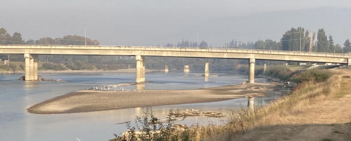
No matter how much rain falls, or how high the Trinity River rises, it is highly unlikely a flood would breech the enormous levees that contain the river as it flows past downtown Fort Worth.

These levees, on the Trinity River, were built over 50 years ago, paid for by the kind taxpayers of America, after the downtown Fort Worth zone was damaged by a really bad flood at some point in time in the early 1950s, if I remember correctly.

I read some news in my old hometown newspaper, the Skagit Valley Herald, this morning, that had me being perplexed. Apparently tomorrow the Mount Vernon City Council is expected to approve a plan to borrow $1 million of the town's future federal funds, to close a funding gap on the $12.9 million cost of Phase II of Mount Vernon's Downtown Flood Protection and Revitalization Project.

Let me explain downtown Mount Vernon and its flooding issue to you.

When the Skagit River goes into big flood mode, downtown Mount Vernon becomes like New Orleans. It is below the level of the flooding river. So, a temporary sandbag dike has to be quickly built, on top of the existing dike, to keep the river from destroying downtown Mount Vernon.

In November of 1995 record rains brought record flooding to all the rivers of the Puget Sound zone. I remember watching the flooding, on TV, at 1 in the morning, when  KING  5, out of Seattle, went live to downtown Mount Vernon where the  KING 5 reporter made it sound as if a fevered effort was underway to save the downtown Mount Vernon library. The TV screen showed a beehive of activity by the library.

I remember being shocked. I woke up some help and headed to downtown Mount Vernon. At the library I found out what was actually going on was a sand bagging operation, with the filled sandbags being brought to the revetment to build a secondary dike. That was where the help was needed, so that is where we went.

Sandbag Wall in Mt. Vernon While the Skagit River Rises
There may have been well over 1,000 people in downtown Mount Vernon working to build a sandbag wall.

Hundreds of National Guard troops were helping.

Sometime around 3 in the morning we were told we'd done all we could do, the sandbags could go no higher.

The Skagit River was expected to crest around 11 that morning. It was expected to crest well over a foot above the sandbag wall. All the businesses in downtown Mount Vernon were sandbagged to help stop the expected flood.

By the time of the crest, I, along with a lot of other people, watched from high ground as the river crept to the top of the sandbag wall. Just as it was starting to go over the top, the river suddenly dropped a foot or more. Everyone was mystified. It was like there had been a divine intervention.

But, we soon were to learn what had actually happened, as emergency sirens sounded and helicopters began to appear. A dike, downriver a couple miles, had popped a couple hundred foot breech, flooding what is known as Fir Island.

Needless to say, Mount Vernon and the Skagit Valley were in a State of Emergency.

And then, 2 weeks later, after the Fir Island dike had been repaired, it happened again.

From that point Mount Vernon decided something needed to be done, after coming to the point of disaster, twice within 2 weeks. In 2007 Mount Vernon bought a mobile flood wall from a Norwegian company, the first such thing to be installed in America. Now, just a few people can put up a wall in a couple hours, where previously it took half a day and 100s of workers.

But, this was a temporary solution. Phase II of the Downtown Flood Protection and Revitalization Project replaces the mobile flood wall with a permanent solution that will take downtown Mount Vernon off FEMA's list of vulnerable flood zones.

That is a list that downtown Fort Worth is not on.

Now, how is it that Fort Worth and its bizarro Trinity River Vision Boondoggle has gotten millions of federal dollars for an un-needed flood control project that will build a likely ridiculous looking, un-needed flood diversion channel, so that the levees that have stopped flooding for decades can be removed?

Meanwhile, Mount Vernon, which has an actual, real, flood problem, that has caused problems for decades, scrambles to find the money to build a permanent fix.

Is this a function of the fact that the congressperson who represents the district in which Mount Vernon is located is not a corrupt politician willing to finagle shady deals to channel federal money Mount Vernon's way, whilst Fort Worth is represented by a corrupt congresswoman who stands to make financial gains from the Trinity River Vision Boondoggle which she has helped to fund, which, in addition to providing her financial gain, also provided her son, J.D. Granger, the job of running the project, a job for which J.D. Granger has absolutely zero qualifications?

The installing her son to run the TRV Boondoggle is sufficient cause to attach the "corrupt" label to this corrupt politician, let alone all the other reasons.

Why do not more people find the TRV Boondoggle's wastefulness and lack of need to be perplexing, particularly when there are locations in America where money could be spent to fix an actual flooding problem?

Places like Haltom City and Mount Vernon.

If you'd asked me if the 1995 flood I'm talking about above was the infamous Thanksgiving Day Flood, I would have said, yes it was. If you'd asked me if this was the flood that sank one of the Lake Washington floating bridges, I would have said yes it was.

Well, just a little Googling let me know I was wrong about the Thanksgiving Day Flood. That flood was in 1990 and was the one that sank the floating bridge.

The fact that I get confused about Western Washington's floods and the fact that some of them have names, should be a good indication of how bad the flooding in that rainy zone can be.

I remember watching the floating bridge sink, on TV, at my sister's cabin at Lake Cushman. That fact confuses me for a variety of reasons. One of which is I also remember being at Seattle's Gasworks Park watching my aunt finish a marathon in the rainstorm that sank the floating bridge. But, I'm further confused, because I remember being up in Lynden, at the Dutch Mother's Restaurant, because my grandma wanted to have all her kids and grandkids together for a turkey dinner for the first time in decades. I remember that night as the night the rain started that became the flood known as the Thanksgiving Flood. Apparently I was all over Western Washington during that flooding period, all the way to the Canadian border, to Seattle, to Hood Canal.

That or my memory is really mixed up.

Below is a YouTube video of part of the KING 5 report about the sinking. There is footage of the actual sinking, which happened live on TV, if I'm remembering right, which I've fairly clearly established may not be the case...

Wednesday, September 7, 2011

Up Before The Sun Again On Day 7 Of September Wondering Why I Can Not Catch A Salmon In The Trinity River

On this 7th morning of September I am again up before the sun, looking out my primary viewing portal on the outer world at swimming pool currently being chilled by a temperature of only 63.

It is being so much easier to get a good night's sleep with no A/C running and no ceiling fan spinning overheard.

I thought of my nephew Joey, up in Washington, in the town of Clear Lake, near the Skagit River in the Skagit Valley, this morning, whilst reading the Skagit Valley Herald online.

Joey is a fishing maniac. Every year Joey catches a lot of salmon, many of which get turned into smoked salmon.

There was a period of time when the salmon runs in the rivers of Washington were in danger, as in few salmon were returning to spawn.

This is no longer the case.

Currently it is the return of the pink salmon that is happening. Pink salmon are also known as humpies. What is happening on the rivers right now is known as humpy mania, as a lot of fishermen are catching a lot of fish.

An estimated 6 million pink salmon are heading up the Puget Sound rivers. Of those, about 1.2 million are swimming up the Skagit, where Joey will catch quite a few.

I don't know if Joey is mailing his favorite uncle any smoked salmon this year.

None of the Puget Sound rivers have signs warning an angler that consuming the fish caught may not be safe.

The same can not be said of Texas where there are rivers and lakes with signs warning anglers that consuming fish caught may not be safe.

 But, it is totally safe to go inner tubing in those unsafe to fish waters.

Wednesday, May 25, 2011

Walkng Late After A No Power Lunch Catching Fosdic Lake Fish Thinking About Safe & Sane River Inner Tubing

There has been no swimming, for me, for two mornings in a row, due to the pool needing to be drained so the underwater lights could be replaced.

Today, at noon, I drove up to North Richland Hills for my weekly Wednesday restaurant rendezvous. As I exited the freeway I got a call telling me the restaurant was closed, due to power being out in the area, due to last night's storm.

North Richland Hills was hit a bit harder, by the storm, than it hit my location.

With the restaurant rendezvous aborted, I continued on to the ALDI Market in Hurst, not knowing if it was powered up or not.

It was.

By the time I had lunch I managed to overeat. I do not like overeating.

Coming up on 5, I decided I needed to get some pedestrian exercise. So, I drove to Oakland Lake Park to walk around Fosdic Lake.

I thought Fosdic Falls might be falling hard due to last night's rain. I was surprised to see Fosdic Falls barely dribbling.

I was also surprised to see so many people angling for fish in Fosdic Lake, where signs warn you to be careful about eating what you catch.

In addition to all the solo fishermen, there were two cute family groups.

The group you see at the top was a grandma, a mom and two kids. I know this because I stopped to talk to them after I took the picture. They'd caught a fish. A very little perch. First fish I've seen caught from Fosdic Lake. I should have asked if I could take a picture of it. But I did not think of that til later.

Grandma told me they don't eat the fish, their cat does.

The other fishing family was a dad with two kids, a girl and a boy. The girl was in a pink ballet tutu.

This group reminded me of my dad. Not due to the pink tutu, but due to the fact that when I was a little kid we'd go on family fishing excursions on the Skagit River. Sometimes it'd just be dad and me and my brother.

The fish one sought from the Skagit was not perch. It was salmon.

My brother strongly caught the fishing gene from my dad. Me, not so much. My brother passed the fishing gene onto my nephew, Joey, who continues to catch a lot of salmon in the Skagit River, without his dad, who has moved to Arizona. Where no salmon spawn in any river. As far as I know.

I never much enjoyed standing on a river or lake bank tossing a fish line in the water. But, I did very much enjoy fishing from a fishing boat out in the San Juan Islands zone. My mom and dad had a nice big boat, sort of a floating camper. Trolling for salmon is fun. Catching cod is fun. Sometimes when trolling for salmon you'd catch a shark instead. Dogsharks. Not as fun as salmon.

My dad caught a halibut over 180 pounds, once, out in the San Juans. I was not along. The local newspaper printed a picture of my dad and the big halibut. I must see if I can locate that picture and one of my dad's dad, my grandpa, with a giant sturgeon he caught in the Nooksack River.

Strange, it never bothered me to float in the Skagit or Nooksack Rivers, particularly the Nooksack. It's a big inner tubing river in summer.

Never crossed my mind to worry about a salmon or sturgeon encounter. No one organizes the massive weekend Nooksack inner tube float parties in summer. It just sort of organically happens.

Not the result of someone's brilliant brainstorm, like the one we learned about yesterday with the announcement of the Trinity River Vision Boondoggle's summer Rockin' the River with Inner Tube Happy Hours.

Tuesday, December 14, 2010

Looking At The Litter In Two Flooding Rivers With One In Texas & One In Washington


Above you are looking at a railroad bridge across the flooding Skagit River, from the Mount Vernon south side of the river, a couple miles from my Washington abode. This picture was taken yesterday.

A log jam has built up against the bridge that has caused some concerns. Bridges in Washington have often been badly damaged by log jams.

The Skagit River is a bigger river than the Trinity River, which is my current neighborhood river. The rivers styles of flooding are quite different. Note how clean the Skagit River water looks. Do you see any litter besides those vexing logs?

I have been looking at a lot of pictures of the current flood event on the rivers of Western Washington. I have not seen any litter floating in the flooded rivers. Not in any pictures or video. I am sure there is some litter floating in the current flood, there would have to be.

But not in the astonishingly copious amounts I have witnessed in the Trinity River.


Above is a picture of the Trinity River during its most recent flood. The picture was taken from the south side of the river, at Quanah Parker Park, about the same distance from my current abode as the first picture, above, was from my Washington abode.

Do you notice any differences? To my eyes the Skagit River appears to be clear, clean water, while the Trinity River looks to be rather dirty, with litter floating in it.

I have boated on the Skagit River, long floats on my rubber raft. I've eaten fish caught in the Skagit River. I have inner tubed the Skagit River. These are things I can not say I have done in the Trinity River. Though inner tubing in the Trinity has become a bit of a fad among life-risking daredevils.

Below is a video of the most recent flood event of the Trinity River. In the video you will see a lot of litter float by. Ironically, this flood occurred a short time after the more dire flood that was caused by the remnants of Hurricane Hermine. One would have thought the supply of Texas litter would have been a bit in short supply for a flood following so quickly after the biggest flood I've seen since I've been in Texas, but one would have been wrong, the supply of litter had been re-stocked, totally ready for the next flood event.

Texans seem to pride themselves on being World Class Litterers. We  like World Class stuff here. Soon we will have the World's Premiere Wake Boarding facility. Where people can come from all over the world to enjoy the fragrant waters of the Trinity River....

Friday, September 10, 2010

Friday Morning In Texas Up Late Thinking About Smoked Salmon

As you can see via the view from my patio, I am up after the sun on this, the second Friday of September, one day before the 9th Anniversary of the 9/11 Terrorist Attacks.

I was surprised this morning to learn that the Florida trouble making preacher was abandoning his plan to burn a Koran tomorrow, due to being falsely assured that that Muslim center was not going to be built near Ground Zero in New York City.

My nephew Joey called last night. He mentioned the Koran burning. Wondering why such a fuss was being made over a potential book burning when it would seem the focus of fussing should be on the behavior of a religion that condones stonings and beheadings.

And murdering thousands by flying planes into buildings.

Joey lives in Clear Lake. The Skagit River is a short distance from Clear Lake. When the Skagit floods it floods all the way to Clear Lake. Joey catches a lot of salmon in the Skagit River. Unlike the Trinity River, here in Texas, you can eat the fish you catch in the Skagit River.

Last night when Joey called he was driving to the lake closest to Clear Lake, that being Big Lake, where his mom, my favorite ex-sister-in-law, lives, to deliver some smoked salmon.

It is time for a very late in the morning swim now. I wonder if I could get Joey to mail me some smoked salmon.