Wednesday, January 5, 2022
Exiting Lucy Park To Wee-Chi-Tah Trail & Alligator Alley
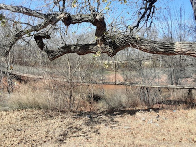
On this morning's long Lucy Park bout of fast walking I exited the park via the suspension bridge suspended over the Wichita River. That is the suspension bridge crossing the river to Lucy Park, you see above.
When one crosses the river one soon comes to the Wee-Chi-Tah Trail. The one and only mountain bike trail in town. I have not rolled my bike's wheels on this trail. I have hiked some of it. If I remember right the Wee-Chi-Tah Trail is around 12 miles long, making a loop. I think.
I know the Wee-Chi-Tah Trail is a challenging trail, with some locations having bypasses to avoid a tricky section.
Today I walked as far as the Alligator Alley section of the Wee-Chi-Tah Trail. Due to the temperature being no where near warm, I was in no danger of a hostile over-sized, cold-blooded lizard trying to eat me.
I believe the black diamond on the above sign indicates the Alligator Alley section of trail is one requiring an advanced skill level. I used to have a fairly advanced skill level for mountain biking, but years of not honing that skill have rendered me wary of anything requiring an advanced skill level.
Have I made mention of Google Fit before? I don't remember. A couple weeks ago I installed the Google Fit app on my phone. One gets it from the Google Play Store. For free.
Google Fit tracks how many minutes you move, how many miles you move, how many calories you burn, and other stuff. Such as keeping an activity log.
You input your age, weight, height and gender, which I guess is sufficient info to calculate calories burned.
I have tested the mileage and move minutes and it is accurate. For example, it is 1.1 miles around Sikes Lake. Google Fit gets that right.
I estimate if I keep up the current pace by the end of this month I will no longer be morbidly obese...
Subscribe to:
Post Comments (Atom)


No comments:
Post a Comment